
The Underground Advantage: How Drones Are Revolutionizing Mining Inside Caves

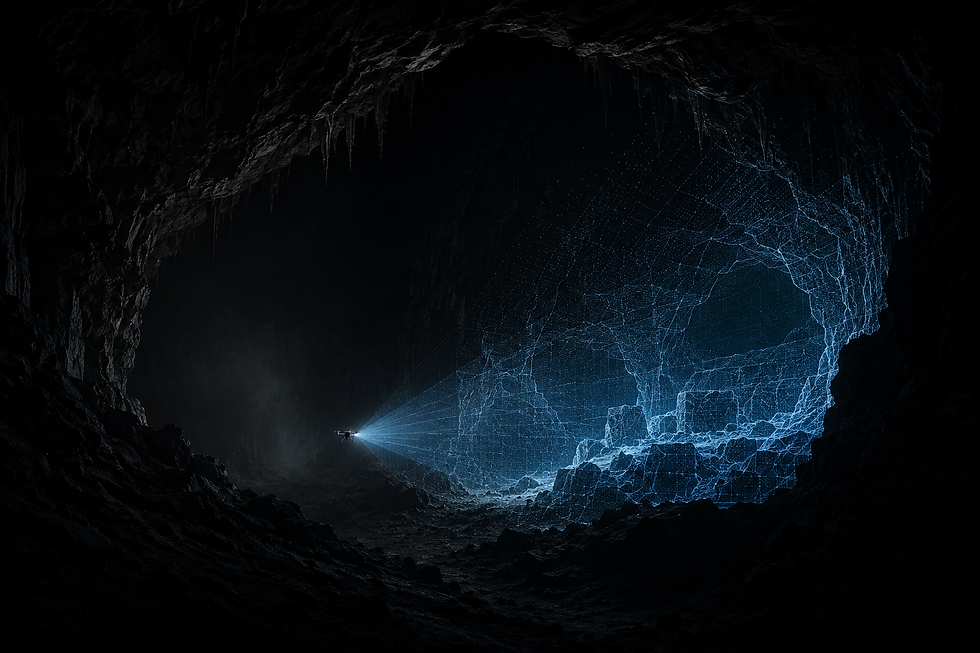
Picture this: a place so dark you can’t see your hand in front of your face. The ground is uneven, the air thick with dust, and a sudden collapse is always one stray vibration away. For decades, this was the reality for miners navigating natural caves or abandoned tunnels, risking life and limb to access the earth’s hidden wealth.
Today, the story is changing — and it’s taking flight.
From the vast chambers of natural cave systems to the tight confines of abandoned or active mines, drones are giving us a safer, faster, and smarter way to explore these dangerous environments. They’re rewriting the rules of underground mining, blending advanced sensors with autonomous smarts to transform how we see, measure, and protect these subterranean worlds.
A New Frontier: Why Caves Matter
You might wonder: why fly a drone in a cave at all?
Natural cave formations and reworked underground mine shafts are more than geological curiosities — they can signal valuable mineral deposits, offer safer ways to sample ore, and hold key data for environmental and reclamation work. In other cases, abandoned mines pose hidden hazards to nearby communities. Inspections are critical but risky.
Traditional survey methods rely on workers entering unstable areas with flashlights, tripods, and tape measures. It’s slow, dangerous, and often incomplete. That’s where drones come in, carrying powerful cameras, LiDAR, and 3D-mapping tools right into the danger zone — while their human operators stay safely above ground.
Navigating the GPS-Free Zone: SLAM to the Rescue
Flying a drone through a pitch-black cave sounds like a horror movie waiting to happen. And without GPS? Forget it — at least until SLAM showed up.
Simultaneous Localization and Mapping (SLAM) is an algorithmic breakthrough that lets a drone build a live 3D map of its surroundings while figuring out its own position inside that map. Think of it as giving the drone a sense of spatial memory, so it can explore without crashing into rock walls.
In cave or mine environments where metal, rock, and water block radio signals, SLAM is mission-critical. It allows drones to:
Create precise 3D cave models on the fly
Avoid tight obstacles with millimeter precision
Work autonomously in complete darkness
Paired with onboard lighting, thermal imaging, or LiDAR, these drones can reveal structures, faults, and ore seams nobody has seen in decades — or ever.
Eyes in the Dark: The Drones Doing the Work
Today’s leading underground UAVs look more like sci-fi props than toys. Caged quadcopters like the Flyability Elios 3 are built to bounce off rock walls and keep flying. Heavy-duty platforms like the DJI Matrice series can carry advanced LiDAR payloads that map entire tunnel systems in a single flight.
Key features include:
Protective cages for confined spaces
Ultra-bright LED arrays
Multi-sensor payloads: LiDAR, thermal, photogrammetry
Powerful SLAM-enabled autopilot
These drones don’t just inspect. They map, they analyze, and they digitally twin underground structures in incredible detail.
Hybrid Dream: Crawlers That Can Fly
Here’s where it gets next-level. Researchers are working on hybrid drones that can fly through large chambers but crawl through tight cracks, combining propellers with leg-like appendages. Inspired by insects, these bio-inspired machines could climb boulder piles, squeeze through cave fissures, and then lift off again on the other side.
Imagine a drone that:
Flies through a vertical shaft
Lands and crawls under collapsed rock
Re-launches once it clears the rubble
This kind of multi-modal mobility could change the game for mine rescue missions, hidden-ore sampling, or even archaeological cave surveys. It’s science fiction on the verge of becoming mining reality.
Why Bother? The Big Benefits
Drone-enabled cave exploration isn’t just cool tech — it’s a practical leap for the industry:
Safety First – Keep people out of dangerous spaces
Faster Mapping – Collect complete 3D models in hours instead of weeks
Cost Savings – Fewer shutdowns, less downtime, more accurate ore yield forecasts
Environmental Gains – Targeted exploration means less damage to ecosystems
Digital Twin Power – Feed data into mine-planning software to monitor collapse zones, ventilation, and even air quality
Underground drones can do in a day what used to take survey teams weeks, without risking a single human life.
The Future: Mining Without a Pickaxe
As underground mining faces rising costs, shrinking deposits, and tougher safety regulations, drones are quickly becoming indispensable. They’re revealing hidden geology, boosting sustainability, and allowing us to tap resources in ways no one thought possible — all while keeping workers out of harm’s way.
The next time you imagine a miner, picture not a hard hat and a pickaxe, but a pilot holding a controller, sending a smart drone through the darkness, lighting up the secrets of the earth like never before.
Stay tuned, because as the industry goes deeper, the future of flight underground is only beginning to take off.
THE FLYING LIZARD®
Aviation-Driven Drone Intelligence™
Where People and Data Take Flight™


Comments