
Navigating the Digital Terrain: A Deep Dive into Drone Mapping Software
- THE FLYING LIZARD

- Mar 17, 2025
- 2 min read
Updated: Jun 27, 2025

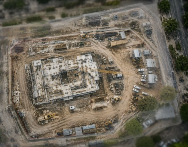
From construction and agriculture to mining and real estate, drone mapping enables professionals to create highly detailed, accurate, and actionable maps. By utilizing specialized software, drone operators can process raw aerial imagery into valuable outputs such as orthomosaics, 3D models, and digital elevation models (DEMs).
Drone mapping, also known as aerial surveying or photogrammetry, involves capturing high-resolution images using unmanned aerial vehicles (UAVs) and processing these images into geospatial data. By flying drones over a designated area in a systematic pattern, operators collect overlapping images that software can stitch together to create accurate maps. These maps are instrumental in land surveying, infrastructure inspection, environmental monitoring, and various other applications.
While drones capture images, specialized software transforms these images into meaningful data. Drone mapping software employs photogrammetry techniques, analyzing multiple overlapping images to reconstruct terrain and objects in three dimensions. Many programs also integrate with Geographic Information Systems (GIS) to enhance spatial analysis and data visualization.
Among the leading software solutions, Pix4D stands out for its precision, enabling users to process images into 2D orthomosaics, 3D models, and DEMs with centimeter-level accuracy. This flexibility, available through both cloud and desktop-based processing, makes Pix4D a top choice for surveying, construction, and agriculture.
Another powerhouse in the industry is DroneDeploy, a user-friendly, cloud-based platform that automates flight planning, image capture, and processing. Its intuitive interface and real-time data processing capabilities make it widely adopted in agriculture, real estate, and construction.
For professionals seeking high-precision results, Agisoft Metashape offers robust image-processing capabilities, making it particularly useful for surveying and archaeological research. Unlike some cloud-based solutions, Metashape enables local processing, ensuring full control over data.
DJI Terra, designed specifically for DJI drones, provides rapid mapping and 3D modeling solutions, making it invaluable for professionals in construction, emergency response, and urban planning. Its real-time 2D and 3D reconstruction capabilities seamlessly integrate with DJI flight planning applications.
Meanwhile, Autodesk ReCap bridges the gap between drone mapping and computer-aided design (CAD) by processing aerial data into 3D point clouds that can be imported into Autodesk’s design tools like AutoCAD and Revit, streamlining workflows for infrastructure development and urban planning.
For construction and earthworks, Propeller Aero delivers precise volumetric analysis, site progress tracking, and terrain comparison tools. Its integration with various drone models and GPS correction systems enhances measurement accuracy, making it a top choice for large-scale infrastructure projects.
Choosing the right drone mapping software depends on specific project needs, considering factors like accuracy, processing speed, cost, and integration with existing tools. Large-scale operations requiring high precision benefit from software like Pix4D or Agisoft Metashape, while those seeking quick and accessible mapping solutions may find DroneDeploy or DJI Terra more suitable.
As drone mapping technology continues to evolve, advancements in AI, machine learning, and cloud computing are pushing the boundaries of automation, real-time processing, and GIS compatibility. These innovations promise to expand the potential applications of drone mapping across industries.
With an array of software options available, professionals can select the best tool to meet their unique requirements. Whether in construction, agriculture, surveying, or infrastructure development, drone mapping software empowers industries to make data-driven decisions with precision and efficiency.
THE FLYING LIZARD™
The world isn’t flat—and neither should your maps be.™


Comments