You can always tell when a man has lost his soul to flying. The poor bastard is hopelessly committed to stopping whatever he is doing long enough to look up and make sure the aircraft purring overhead continues on course and does not suddenly fall out of the sky. It is also his bound duty to watch every aircraft within view take off and land.
- Earnest K. Gann
BLUE HERON ESTATES MISSION
BLUE HERON ESTATES PHASE ONE – MID-BUILD
Airborne. All In. Always Accurate
Luxury Home Development in Buda, TX
The Blue Heron Estates development in Buda, Texas, continues to rise from the ground — a once-vacant stretch of land now steadily transforming into a thriving neighborhood. This mission marks the midway point of Phase One, with roughly one-third of the homes now standing and the rest in various stages of progress.
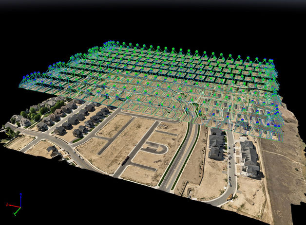
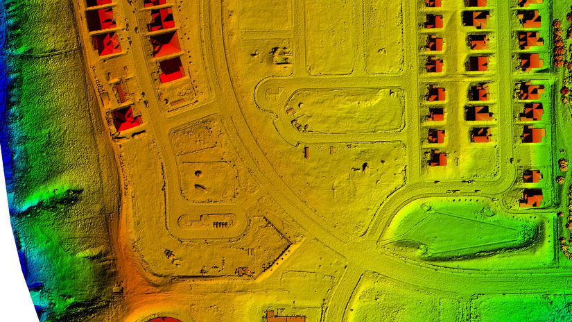
Using the DJI Matrice 4E, The Flying Lizard team conducted an in-depth aerial mission designed to provide progress reporting, volumetric data, and detailed visual updates for both project managers and stakeholders. Every image captured serves a dual purpose — keeping construction teams aligned on measurable milestones, and providing the marketing team with high-impact visuals that showcase real momentum.
Deliverables from this flight include 3D models, orthomosaic maps, volumetric reports, and high-resolution aerial photography, offering both the technical precision needed for accurate oversight and the aesthetic appeal to fuel investor and community engagement.
This project has seen its share of past challenges — delays, cost overruns, and communication gaps — but the integration of drone-based reporting has brought a new level of clarity and accountability to the process. Stakeholders now have real-time visibility into site development, helping keep the project on budget and on schedule.
As Phase One nears completion, The Flying Lizard will continue providing routine aerial intelligence to ensure progress remains steady and transparent. Each mission reinforces the goal that defines every partnership — building smarter, safer, and more connected communities from the ground up.
Mission Data Snapshot
Date of Flight: August 2025
Location: Loveland, Colorado
Conditions: Partly sunny skies
Platform: DJI Matrice 4E
Flight Time: 5 minutes, 48 seconds
Area Covered: 34.9 acres
Flight Altitude: 200 feet AGL
Ground Sampling Distance (GSD): 2.46 cm/pixel
Images Captured: 246
Technical Insight: Despite mixed lighting conditions, data integrity remained high across all datasets, validating consistency in both volumetric and 3D modeling outputs.
Blue Heron Estates Flight

[click above image] to enlarge
[click below images] for more information
THE FLYING LIZARD
Where People and Data Take Flight
The world isn’t flat—and neither should your maps be.™


